Villa Ravensbosch or Villa Vogelenzang
Beekstraat, Valkenburg
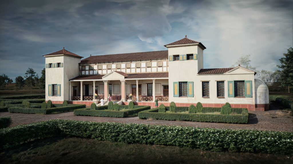
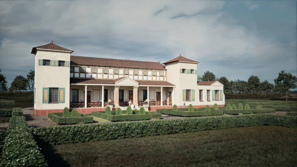
The remains of Villa Ravensbosch are remarkably well preserved. The villa lies at the foot of a slope and was covered by soil that slid down after the Roman period. The National Museum of Antiquities, in cooperation with the LGOG, excavated the Roman villa of Ravensbosch between 1922 and 1923. Both the monumental main building and a rectangular annex were uncovered. However, it cannot be ruled out that more buildings once belonged to the villa. Could they still be hidden underground? After the excavations, the remains were left exposed for a long time, which caused deterioration. Fortunately, a few years ago they were partly covered again, providing better protection.
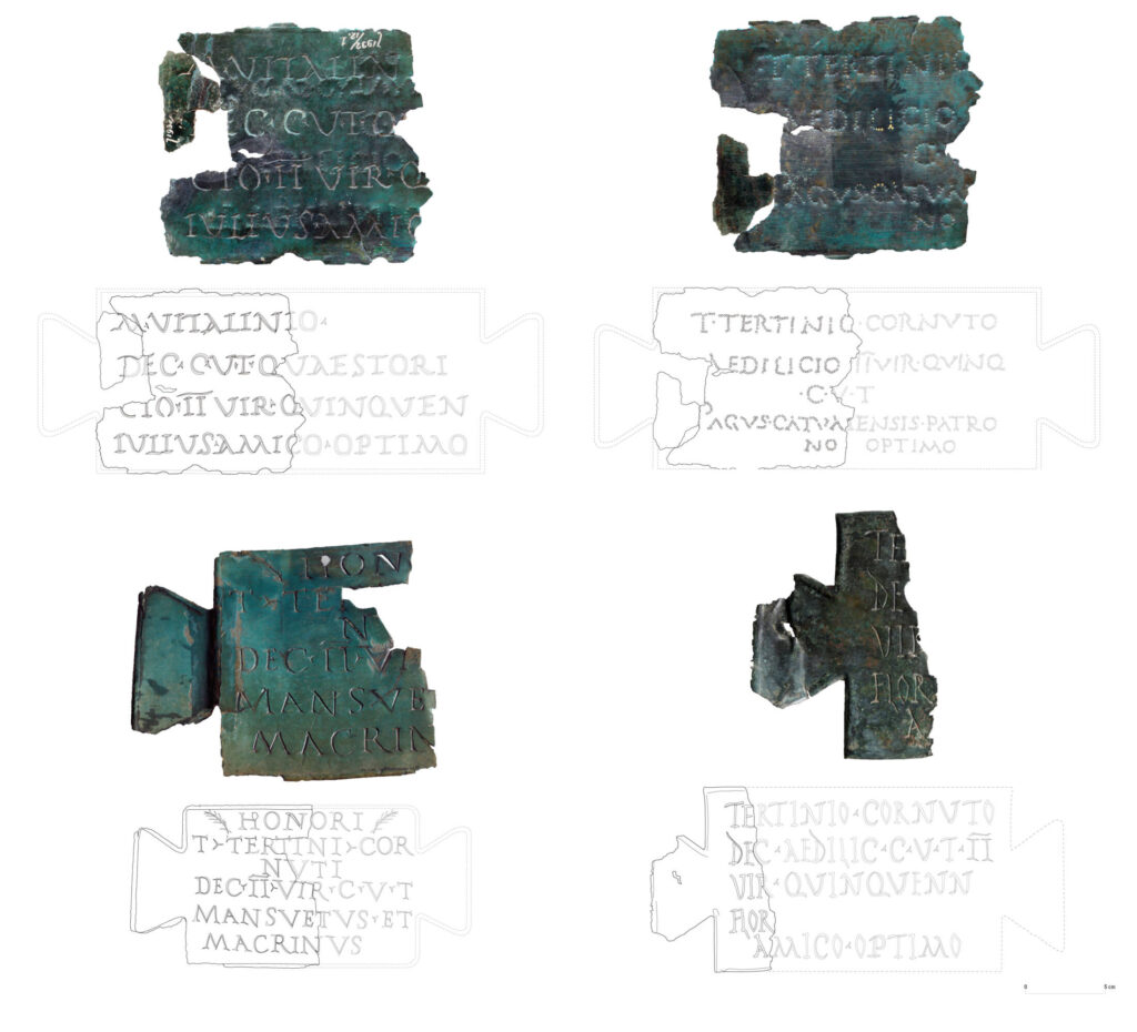
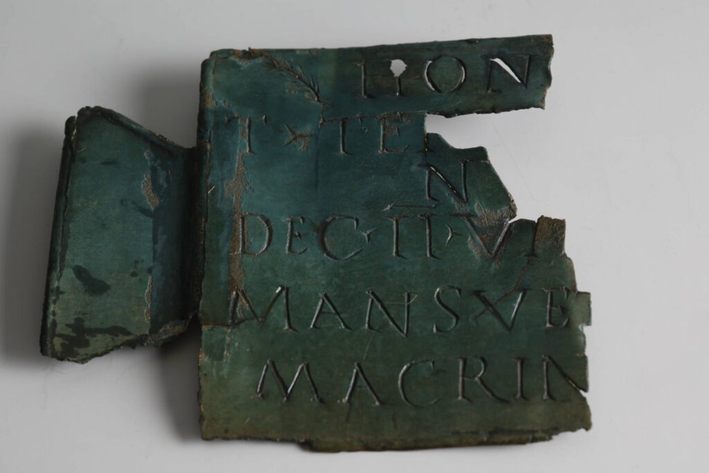
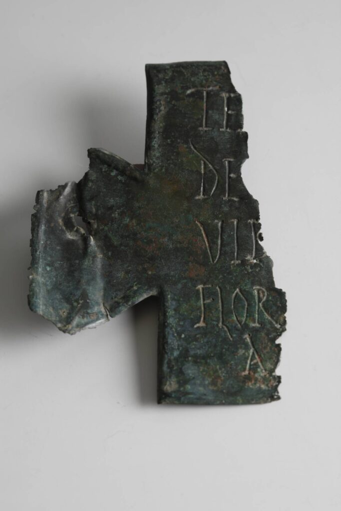
The main building of the villa was probably constructed in several phases. In its final phase it reached its greatest size, featuring a luxurious room with underfloor heating as well as a bathhouse. Despite this luxury, Villa Ravensbosch was certainly not the most imposing villa complex in Limburg. Still, some remarkable objects were found, such as fragments of three bronze plaques with Roman inscriptions. These so-called ‘friendship plaques’ were dedicated to Marcus Vitalinius and Titus Tertinius Cornutus, two residents of the villa. They were members of the city council of Xanten and belonged to the highest elite of both the city and the Roman province.
In 1939, the well-known Limburg amateur archaeologists Beckers and Beckers found remains of the Roman road near the Putweg in Ravensbosch — the Via Belgica! At this location, a dozen Roman villas with annexes have also been discovered: a true vicus or Roman village. Thanks to the fertile loess soil, the area was ideally suited for agriculture.
Fun to know
- Why did ‘high-ranking men’ live in the modest Villa Ravensbosch?
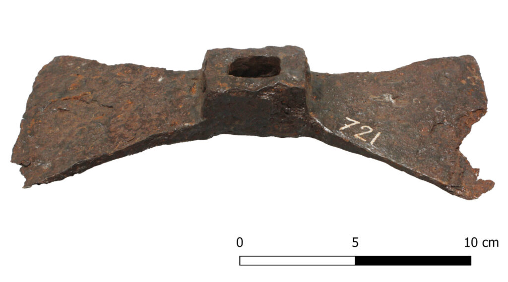
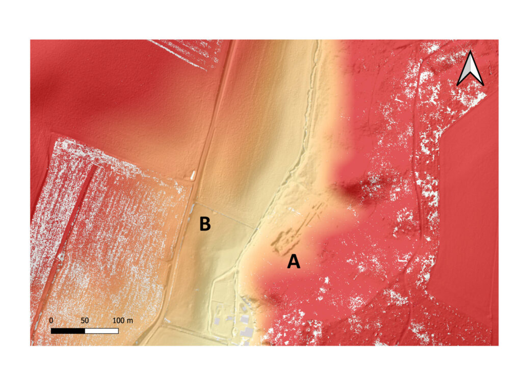
- It is remarkable that these ‘high-ranking men’ lived in the relatively modest Villa Ravensbosch. One would rather expect them in a larger and more luxurious villa. There is a second striking feature of Villa Ravensbosch: its location. Most villas in the hill country were built halfway up the slope, usually facing south to receive the most sunlight. Villa Ravensbosch, however, lies at the bottom of a slope and is oriented to the northwest. As a result, it must often have been in the shade. So why did the wealthy owners choose to live here? A look at the relief map shows that Villa Ravensbosch (A) lies in one of the narrowest parts of the narrow valley of the Strabeek. Although this is only a modest brook, a dam in the valley could easily have created a large water reservoir, as can still be seen further upstream today. On the relief map, a possible remnant of such a dam is visible (B), at the spot where the path now leads to the road. The water from the reservoir could have been used to power a water mill for grinding grain from the surrounding villas. The so-called rijn or molenijzer (an iron clamp from a large millstone) found at Villa Ravensbosch points to the presence of a mill. The location of Villa Ravensbosch, then, was not so strange after all! It was probably also much more efficient to transport flour instead of grain, since it took up less space and was lighter. However, the flour had to be used quickly because it did not keep as long as whole grain. It is therefore likely that it was transported to larger towns and cities in the region — perhaps even to Xanten. This could explain why officials from that city were the owners of the villa: they had a direct interest in the food supply of their own community.
- Copyright Images
- Reconstruction Villa Ravensbosch – Remy Kooi Submedia, Bronze friendship plaques – Image after Derks 2011, 120–123; Figures 5–8. Reproduced with permission of Ton Derks and the Municipality of Maastricht. Relief map – Jasper de Bruin, Mill clamp (molenijzer) – Centre Céramique – Maastricht Museum – LGOG collection