Via Belgica in London Underground style
Author: Harry Lindelauf
Photography: Sasha Trubetskoy
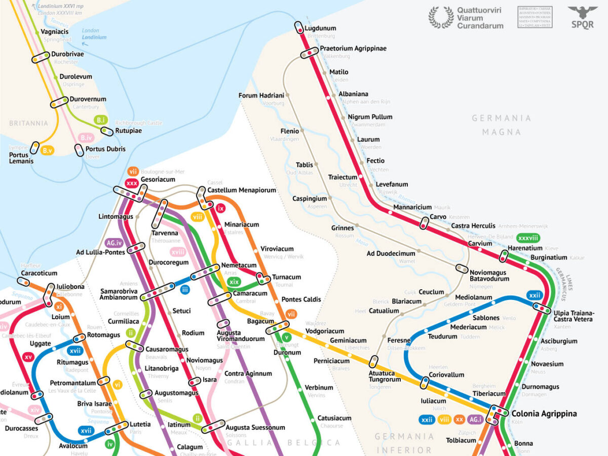
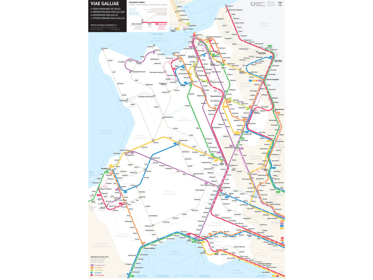
What do you get when you combine contemporary design skills with centuries-old Roman facts? The answer: a surprising map in London Underground style of the Roman roads in Gaul, including the Via Belgica. The American designer Sasha Trubetskoy had the idea, the skill, and the perseverance to create this tour de force.
At first glance, you are looking at a map like the ones we know from public transport, based on the design of Harry Beck from 1931. A fresh simplification of reality, intended to quickly give you insight as a traveller. Upon closer inspection, the Roman place names make it clear that you are looking at the Roman roads around the year 180. The design is a gigantic step forward compared to the Peutinger Map of the Roman road network. With his new approach, Trubetskoy has created a modern artwork on which the Via Belgica also appears. Mentioned are the well-known place names such as Atuatuca Tungrorum (Tongeren), Coriovallum (Heerlen) and Juliacum (Jülich). If you consider it sufficient as art: for a modest sum you can buy the map in high resolution so that the print can adorn your wall at home. See the website of Sasha Trubetskoy.