Agrippastraße in Königsfeldertal in Kall
Agrippastraße in Königsfeldertal
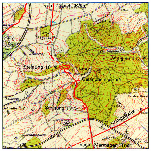
A little further south, it splits into a western route towards Marmagen and an eastern route towards Görresburg and Nettersheim. After about two kilometers, the eastern route leads into the Königsfeldertal valley with its steep ascents and descents. This posed a challenge for the Roman road builders, as the road could no longer be built in a straight line.
Beyond the lead mine, the route of the Agrippa Road is once again recognizable as a dirt track. On the hill visible from here, next to the road, there may have been a signal station in Roman times, from which traffic was monitored. Such stations also served as starting and ending points for surveying straight routes – like the Agrippa Road, whose 17-kilometer-long, straight main section through the Eifel region ended here.
On the north side of the Königsfeld valley, a sunken lane is visible at the steepest point, leading downhill in a wide arc. Archaeologists have discovered a track in a rocky ridge, which, based on its width, could be Roman. Almost parallel to the relatively flat route for the descent, there was a more direct route for the ascent, with a gradient of up to 16 percent.
In the valley, marshy terrain and the extension of another rocky ridge made further progress difficult. Interestingly, the road builders didn’t route the road around the ridge, but instead removed the obstacle. The resulting gap is still visible today as a small remnant of the ridge further down the valley to the east. It’s possible that farmers have widened it in more recent times.
Fun to know
- Photo: geobase data of the municipalities and the state of NRW: © Geobasis NRW