Roman road on the plateau in Nettersheim
Roman road on the plateau
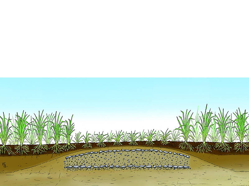
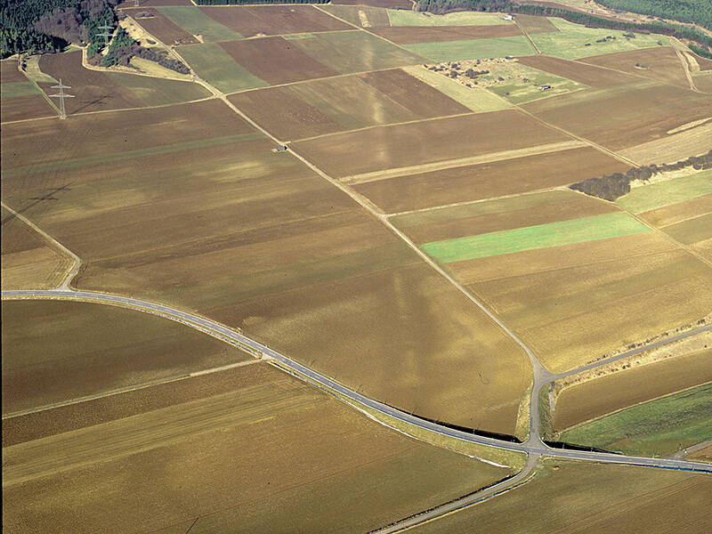
This is how one imagines a Roman road: From the southern slope of the Urft valley to today’s district road 59, the Agrippa Road ran in a straight line across flat land. From the air, it is still clearly visible as a light-colored strip. This is due to the different vegetation: Beneath the current surface, the gravel track of the Roman road is still present. Plants cannot develop roots as deep there as in the loose soil to the right and left of the track.
The road’s course in this area is only visible from the air. On the ground, the former Roman road is barely discernible and, without the markings of trees, is almost impossible for hikers to spot.
Where the landscape allowed, Roman road builders constructed their routes in the mountains as straight as possible, thus taking the shortest route between two destinations. They only had to make exceptions when faced with obstacles such as river valleys or hills. Further south from here, the route descends into the Schleifbach valley through a cutting. A branch of the road formerly climbed steeply to the spur of the “Görresburg.” It is likely that a variant of this route ran along the foot of the hill, where traces of the path can still be found today.
Fun to know
- First photo: vegetation on soils with different properties. Illustration: F. Spangenberg, Illu-Atelier
- Second photo: from the air, the perfectly straight course of the Via Agrippa between the Urft Valley and the regional road (Kreisstraße 59) is clearly recognizable. Photo: G. Amtmann, LVR Office for Monument Preservation in the Rhineland