Roman Burial Field Aachener Weiher in Cologne
Roman Burial Field
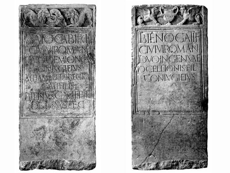
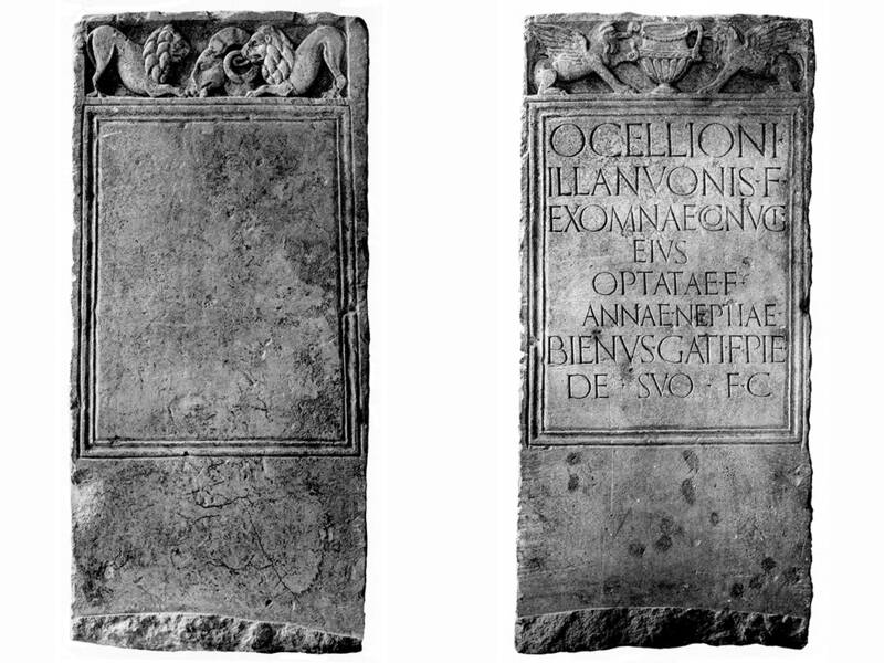
In Roman times, the road continued for about two kilometers through extensive burial grounds. According to Roman law, these could only be located outside the city walls. The design of the above-ground graves depended on the wealth of the family. Imposing tombs were concentrated in prominent areas near the road. Inscriptions, statues, and reliefs reminded passersby of the deceased, their origins, and their achievements.
Today, Aachener Straße—now the main east–west axis of modern Cologne—cuts through the inner green belt. The Aachener Weiher pond is part of these parklands. They were created in the 1920s in the area of the inner fortification ring after the demolition of the Prussian fortress of Cologne. Fort VI “Frederik der Nederlanden” also fell victim to this demolition. When this fortification was built directly next to Aachener Straße, the course of the road was preserved.
The surrounding hills of the Aachener Weiher consist of rubble from the city destroyed during the Second World War and cover the former “Maifeld,” a site used for military parades by the National Socialists in the Third Reich, accommodating up to 200,000 people.
The Museum of East Asian Art is located on the western side of the Aachener Weiher. It was built in 1977 according to a design by the Japanese architect Kunio Maekawa.
Fun to know
- Photos: The Celt Bienus had four gravestones erected: one for his parents and brothers, one for his parents-in-law and their family, one for himself and his wife, and (without inscription) possibly one for his descendants. The four gravestones were sawn from a single block of limestone. Bienus was an immigrant from Northern France, descended from the Viromand people. Location: Aachener Straße 19-21. © Roman-Germanic Museum. Rhineland Photo Archive Cologne