Vicus Neubourheim in Jülich
Vicus Neubourheim
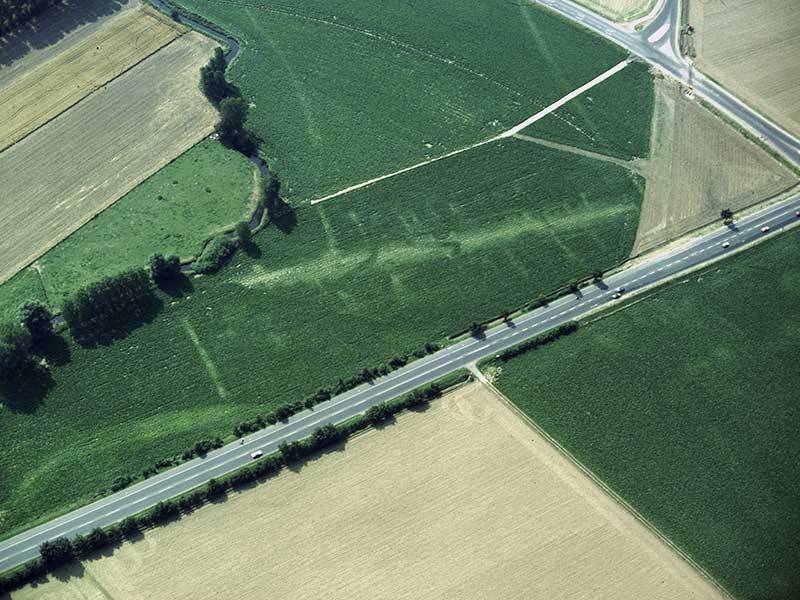
At this location, there was once a Roman settlement. Archaeologists first found evidence of it in the 1960s—at that time, a field survey revealed a Roman debris site measuring approximately 250 by 80 meters. Later aerial photographs indicated a roadside settlement (vicus) covering about 4.5 hectares.
A straight band, between six and twelve meters wide, runs through the area and stands out clearly from its surroundings: this was the former road. Several lighter strips branch off from it at right angles on both sides. Like the vicus of Iuliacum on the right bank of the Rur, this settlement served as a stopping place at a location where travelers were forced to halt when the river could not be crossed due to flooding. In 2003, archaeologists measured the magnetic field in this area. This revealed clear irregularities on both sides of the road alignment, indicating the presence of structural remains.
The settlement area of a vicus was typically divided into long, rectangular plots laid out at right angles to the road. Within these plots, the building layout followed a set pattern: elongated houses stood along both sides of the road, with their gable ends facing the street. Narrow gravel paths or so-called drip alleys (Traufgassen), through which wastewater could drain, often ran between the houses. The houses frequently also shared walls. The areas behind the plots were used by the inhabitants as gardens or as spaces for workshops and commercial activities.
Fun to know
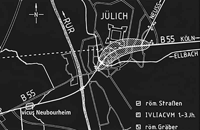
- First photo: crossing of the Roman road in the Rur Valley. Graphic design: M. Perse, drawing: M. Najdul
- Second photo: aerial photo of the Roman settlement west of Jülich on the Aachener Landstraße. Photo: G. Amtmann, LVR Archaeological Heritage Management Office