Agrippastraße at the Ville
Agrippastraße at the Ville
The modern Luxemburger Straße, which follows the ancient Agrippastraße in a straight line for eight kilometers from Cologne, turns south here. An archaeological survey, conducted to assess the condition of the ancient road, revealed that the Roman road was destroyed at this point – likely in connection with the construction of the old B265 highway. From this point, the industrial road leading to the Hürth-Knapsack chemical park follows the route of the Roman road for another 500 meters.
On its journey from Cologne to Trier, the Ville hill, almost 200 meters high, was the first obstacle the Agrippa Road had to overcome. However, for the Roman road builders, this was no reason to deviate from the usual straight route.
From the industrial park onwards, the ancient road has given way to the “Vereinigte Ville” open-cast mine, extending almost to Liblar at the western foot of the Ville hills. The now reclaimed area is a local recreation area, its lakes remnants of the former open-cast mine.
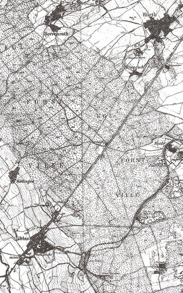
The course of Agrippastraße in this area can be completely reconstructed with the help of historical maps, such as the French map survey of the Rhineland by Tranchot and von Müffling (1801–1828) or the Prussian maps from the 19th century.
In the ancient route, a barely perceptible bend can be observed at the highest point of the Ville. It lies near the late Roman fortification “Villenhaus” and is possibly due to a surveying error by the Roman road builders. From here, there is a view of both Cologne and Zülpich.
Fun to know
- Photo: the route of the Via Agrippa over the Ville on the Prussian New Map of 1845. Geobase data of the municipalities and the state of North Rhine-Westphalia: © Geobasis NRW