Agrippastraße in Kall
Agrippastraße
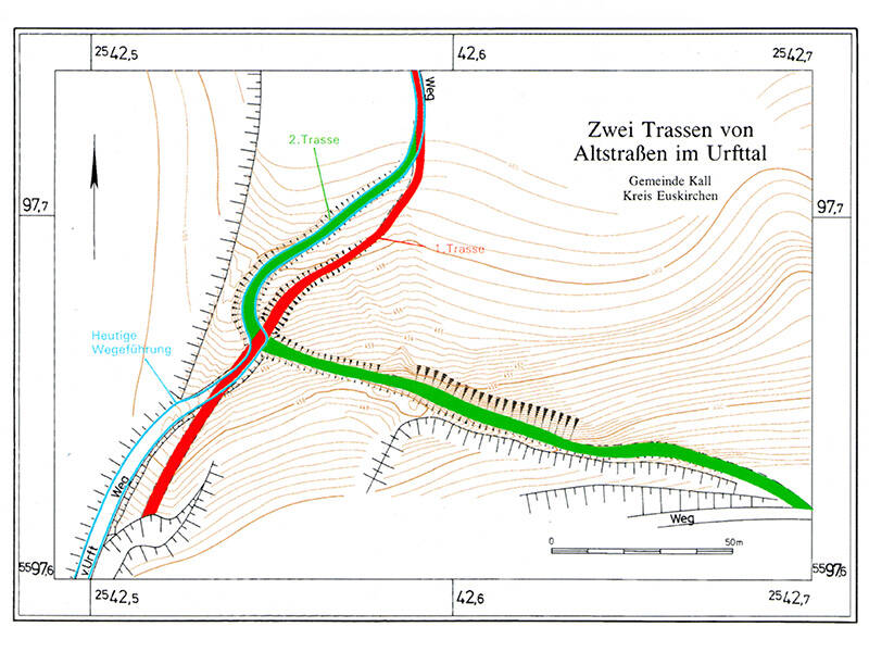
Uphill, downhill, and winding several times: Between Kall-Keldenich and Marmagen, the Agrippa Road, which had been perfectly straight until then, split into two branches. They diverged on the north side of the deeply incised Urft Valley and led down to the river via different routes. The eastern route turned almost at a right angle after the fork and descended diagonally along the slope, with a gradient of more than 20 percent. To make this route possible at all, the rock had to be cut almost five meters deep – a difficult and time-consuming task.
The western route, which bypassed this point, headed more or less straight down into the valley after the fork. It followed the narrow ridge of the promontory that rises at the distinctive bend of the Urft River. This section, with a gradient of only 13 percent, was considerably flatter. After both routes had crossed the Urft in the valley – presumably via a ford – they rejoined. From there, the Agrippa Road climbed the southern slope and continued across the plateau towards Marmagen.
What’s curious about this route is that the two paths crossed again shortly after their fork (a “spaghetti knot”). It’s possible the paths were built sequentially. Older maps only show the eastern route. However, it could also be that the flatter route was used only for the more challenging downhill section. This was more demanding because a cart could slip even with locked wheels and collide with the draft animals. On the uphill section, however, additional animals could be harnessed (team service), allowing steeper gradients to be negotiated.
Fun to know
- First photo: the “spaghetti knot”: Two paths with different gradients lead to the Urft valley. Illustration: U. Ullrich-Wick, LVR Office for Monument Preservation in the Rhineland
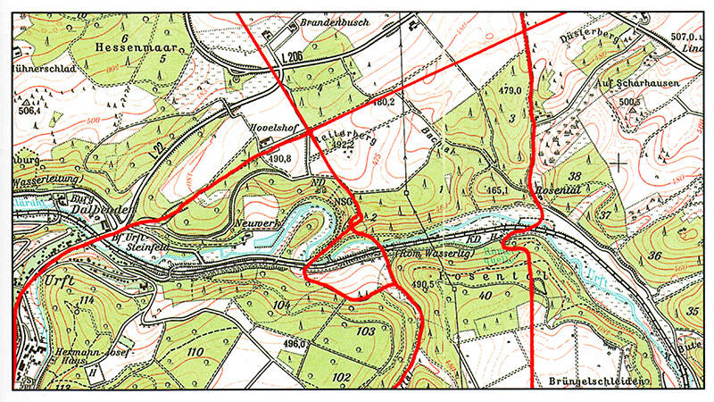
- Second photo: geobasis data of the municipalities and the state of NRW: © Geobasis NRW