Agrippastraße in the Olbrück Forest
Agrippastraße in the Olbrück Forest, Blankenheim
Agrippastraße runs in a straight line from Nettersheim towards the Olbrückwald forest – almost exactly north-south. Shortly before reaching the forest, it curves slightly southwest and joins the present-day B51. This wasn’t always the case: there are indications that an older route existed during the Roman Empire. This earlier route didn’t bend but continued straight on to Jünkerath. The reason for the construction of the new route is believed to be that the increasing volume of goods transported needed to be handled via a more convenient road.
The embankment of the more recent section of the railway line is still well-preserved and marked with stakes in the forest. The route was also clearly traceable in the field south of the Olbrück Forest, thanks to the pebbles and limestone rubble from the former embankment that had been plowed up. However, there it is now covered by a meadow and bordered by trees along its entire width.
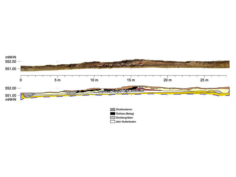
The typical structure of a rural Roman road can be seen in the southern part of the Olbrück Forest. Beneath a protective roof, a test trench reveals the profile of the road’s route. Directly onto the existing topsoil, the Romans laid a six-meter-wide layer of crushed limestone. On top of this, they applied a 20-centimeter-thick, compacted mixture of gravel and sand. The actual roadway consisted of a continuously renewed wearing course of gravel.
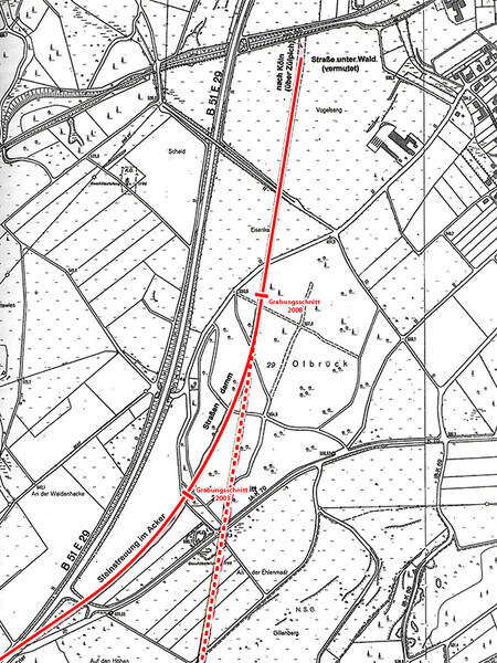
In a test trench on the north side of the Olbrück Forest, the route was surveyed across its full width of 25 meters. On both sides of the road embankment, the ten-meter-wide summer paths, intended for pedestrians, horses, and livestock during the dry season, and the two roadside ditches were uncovered.
Fun to know
- First photo: the profile along the Via Agrippa shows the construction of the road. Graphic and photomontage by K. Lang-Novikov/ R. Dortangs, LVR-Amt für Bodendenkmalpflege im Rheinland
- Second photo: location of the investigation areas (soundings). Geobase data of the municipalities and the state of North Rhine-Westphalia: © Geobasis NRW