Roman road junction in Nettersheim
Roman road junction
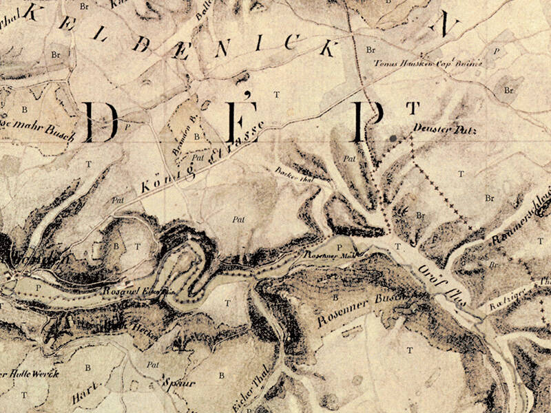
Two roads once intersected at this point, both still in use at the beginning of the 19th century. The Agrippa Road ran from north to south, leading from Cologne via Zülpich to Trier. A road, presumably from Wesseling on the Rhine via Euskirchen-Billig, the Roman vicus Belgica, came from the northeast.
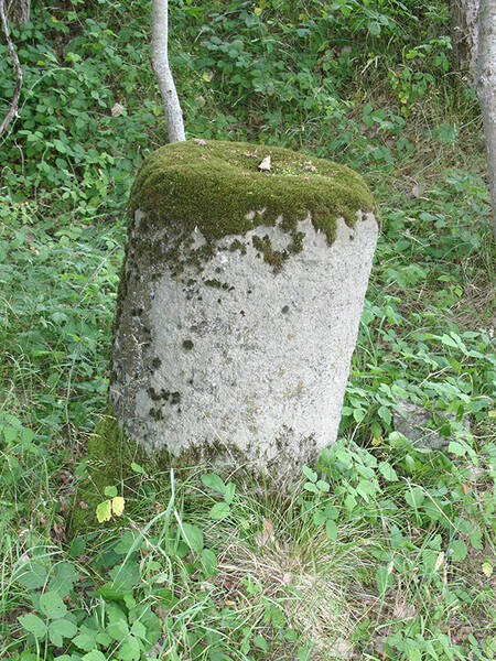
The road continued through the present-day villages of Urft and Marmagen, where, south of the village and near the road’s course, the “Round Stone” can be found. It is likely the base of a Roman milestone, intended to inform passersby about the distance to the next larger town or city. This route is marked as “Königstraße” (King’s Road) on a historical map from the early 19th century.
The routes of Roman roads were used in some places for centuries. Even today, they still serve as roads, paths, or trails in certain locations. For example, a farm track still runs along the route of the Agrippa Road at this point. South of Marmagen, the two roads that intersected here merged to continue southwards together.
Fun to know
- First photo: fragment of the map of the Rhineland made by Tranchot and von Müffling. Geobase data of the municipalities and the state of NRW: © Geobasis NRW
- Second photo: the "Round Stone" south of Marmagen. Photo: K. Grewe, LVR-Amt für Bodendenkmalpflege im Rheinland