Serpentine Rosenthal in Nettersheim
Serpentine Rosenthal
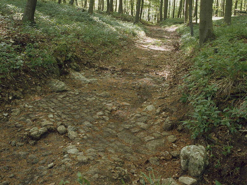
Winding and distinctive – that’s how one could describe the branch of the Agrippa Road that led down the southern slope of the Rosenthal as a sunken lane into the Urft valley. Despite the steep gradient, the road was used by carts in Roman times. This is evidenced by ruts cut into the rocky subsoil. Meltwater and rainwater were drained away via a paved transverse channel.
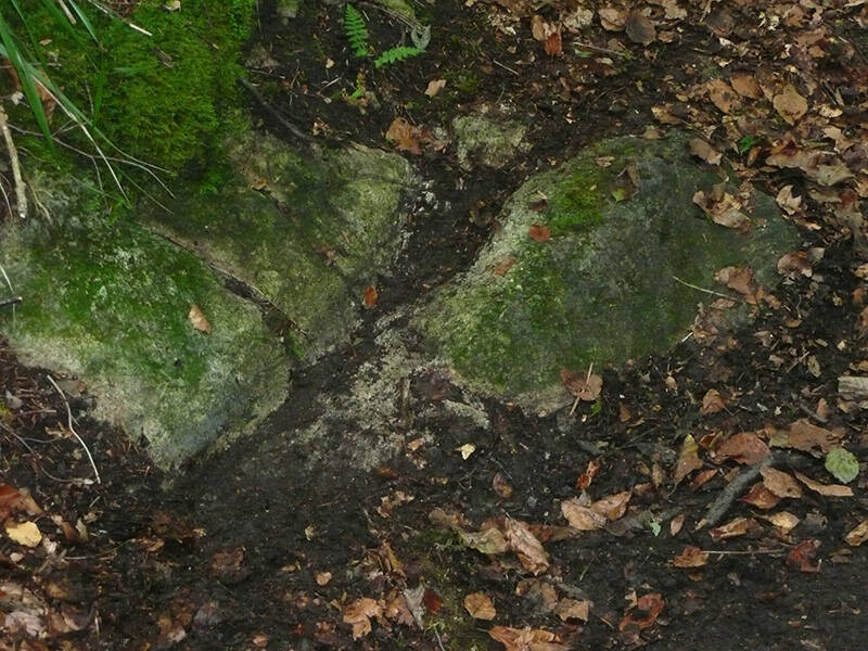
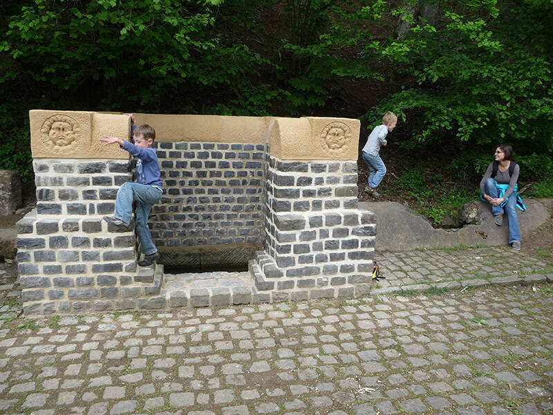
At the foot of the slope, not far from the road and easily accessible from the hiking trail, lies the “Grüner Pütz” (Green Well). This is where the Roman Eifel Aqueduct began, supplying ancient Cologne with fresh spring water.
A seepage pipe serving as a spring catchment, a basin decorated with Medusa heads, and the first section of the Roman canal can still be seen there. While the Agrippa Road mostly ran straight towards Cologne, the aqueduct from the “Grüner Pütz” led in a wide arc to the former Roman provincial capital, as it had to be constructed with a constant gradient and bypass mountains.
Between the present-day towns of Kall and Schmidtheim, the Agrippa Road split into two routes. This branch, with its winding section along the hillside, formed the straighter and shorter north-south connection. The other route led from the north across the Urft River, through the Eichter Valley, and via present-day Marmagen, before rejoining the first route.
Fun to know
- First photo: traffic could drive here: wheel tracks in the rock. Photo: I. Ristow, Municipality of Nettersheim
- Second photo: the catchment spring of the "Grüner Pütz": fresh spring water flowed from here to Roman Cologne. Photo: I. Ristow, Municipality of Nettersheim
- Third photo: since the route was exposed in 1994, the paved transverse trench above this location is clearly visible. Photo: K. Grewe, LVR-Amt für Bodendenkmalpflege im Rheinland