Via Agrippa in Erftstadt
Via Agrippa
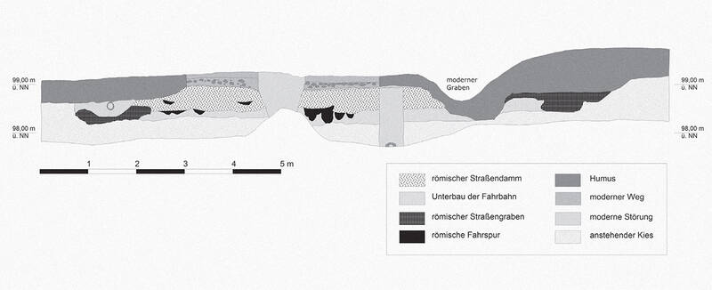
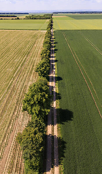
The Agrippa Road between Cologne and Zülpich can still be followed today for almost 35 kilometers. With few interruptions, the course of modern roads and field paths corresponds to that of the Roman highway. This is also the case here, near the Römerhof stud farm, where a small-scale profile section was excavated in 2004 for the archaeological investigation of the road.
Remnants of the Roman roadbed lie 30 centimeters below the modern dirt track. The road embankment is 8.30 meters wide. The dating of two ditches located alongside it is uncertain. Since the road remained in use throughout the centuries, this could also be assumed for the ditches. In this case, the road, including the ditches, would have a total width of 11.40 meters. It is possible that, as was the case elsewhere, one or two unpaved lanes, so-called summer paths, were laid out alongside the road and ditches.
To construct the road, the Roman engineers first removed the existing topsoil as well as approximately ten centimeters of the underlying gravel layer. Three layers of clayey loam applied to this level formed the substructure of the roadway. Numerous cart tracks cut into the soil attest to the fact that the route was used by carts during the construction period. The road surface itself consists of dense gravel and is still preserved to a depth of up to 22 centimeters. The two-layered structure of the road is clearly visible in the cross-section.
Fun to know
- First photo: profile through the Via Agrippa. Source: LVR-Amt für Bodendenkmalpflege im Rheinland
- Second photo: by P. Gawandtka