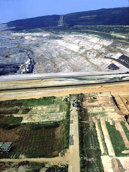
Via Belgica in the Hambach Open-Pit Mine
Via Belgica
Almost nine kilometers of the ancient long-distance road have been lost to the Hambach open-pit mine since 1978. This, however, made systematic archaeological investigations possible: for the first time, such a long section of a Roman state road could be studied intensively. Excavation and survey work carried out until the late 1990s provided entirely new insights into the ancient road system and the Roman settlement landscape.
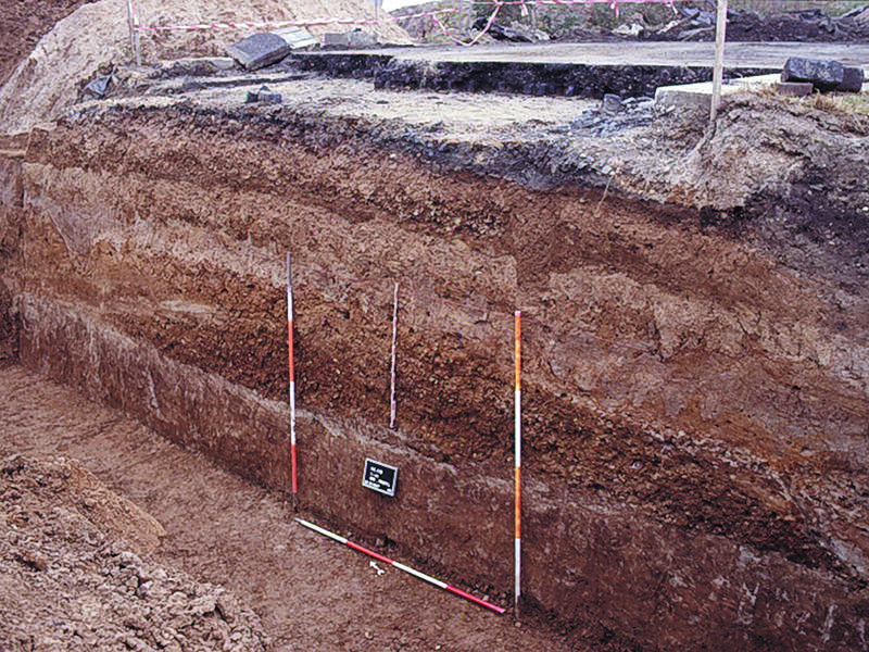
The construction of the ancient roadbed was examined through numerous profile cuts. The total width of the road—from ditch to ditch—was approximately 25 meters. The gravel road embankment was about seven meters wide at its base and up to 60 centimeters thick. In addition to several phases of construction and repair, wheel ruts from heavy carts could be observed in many places. The embankment was flanked on both sides by so-called summer paths, which were in turn bounded externally by road ditches.
The roadside buildings consisted not only of individual houses and estates, whose plots extended close to the road, but also of building complexes associated with road infrastructure: for example, a group of buildings at Eschergewähr, delineated by a ditch, was probably a civilian roadside station where travelers could find lodging and food. Archaeologists found a similar situation west of Steinstraß. Numerous graves on both sides of the Via Belgica were sometimes grouped into cemeteries, sometimes marked with grave monuments. In addition, cult areas and fortifications were identified. Overall, twenty years of archaeological research revealed a picture of a densely settled landscape along the Roman long-distance road.
Fun to know
- First photo: cross-section of the Via Belgica. Photo: H. Haarich, LVR Bureau for Archaeological Heritage Management in the Rhineland
- Second photo: excavations along the Via Belgica at the edge of the Hambach open-pit mine. Photo: G. Amtmann, LVR Bureau for Archaeological Heritage Management in the Rhineland