Agrippastraße in Mürel in Nettersheim
Agrippastraße in Mürel
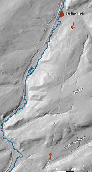
Antiquity meets high-tech: Thanks to airplanes and laser scanners, the perfectly straight Agrippa Road, running between the slopes of the Urft Valley and the Haubach Valley, is visible again. Because the road now lies in a wooded area on the Mürel ridge and is not marked by a prominent embankment, its route had been lost for a time.
This changed with the aerial laser scan: some of the signals also reached the forest floor, so that after filtering out the trees, a relief of the terrain surface emerged. In this way, a roughly two-kilometer-long section of the Agrippa Road route, running straight south, became visible. Previously, the discovery of a gravel strip, which had been noticed during geological surveys, had already indicated road construction work in the area.
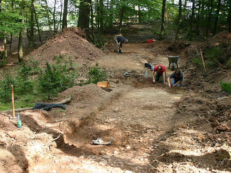
In 2009, archaeologists examined the ground and documented remnants of the road, possibly from two parallel routes. The reconstructed width of one section of the road is a considerable 23 meters. Approximately 2.5 kilometers south, in the Olbrück Forest near Blankenheim, a section of the road of roughly the same width has been uncovered.
Fun to know
- First photo: the LVR-Amt für Bodendenkmalpflege uncovered the route of the road that ran here in 2009. Photo: I. Ristow, Municipality of Nettersheim
- Second photo: laser scan of the Mürel: the route of the Via Agrippa is clearly visible in the forest floor. Illustration: K. Lang-Novikov, LVR Office for Monument Preservation in the Rhineland. Geobase data of the municipalities and the state of NRW: © Geobasis NRW