Agrippastraße in the Dahlem Forest
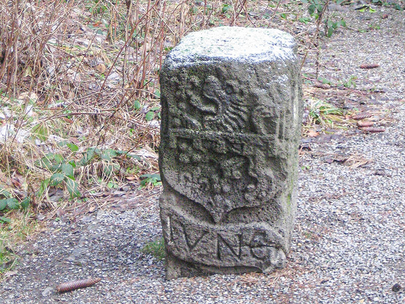
Vierherrenstein
Four territories converged at this point around 500 years ago: Jünkerath, Kronenburg, Schmidtheim, and Blankenheim. The coats of arms and initials of the first three territories are still clearly visible on the basalt lava boundary stone. Much suggests that the side facing the village of Esch formerly bore the coat of arms of the House of Blankenheim.
Here in the Dahlem Forest, on the border between North Rhine-Westphalia and Rhineland-Palatinate, the Agrippa Road winds its way through the terrain in wide serpentine curves. Unusual for a Roman road, but there’s a simple reason: the road engineers based their route on the ridge between Esch and Schmidtheim, which forms a prominent watershed between the Kyll and Ahr rivers. Such a ridgeway remains passable even when the river valleys are flooded.
Originally, the road was 5.55 meters wide. To build it, the road builders first removed the topsoil and layered weathered gray sandstone onto the clay soil to stabilize it. A thin layer of rubble covered the sandstone. Finally, the roadbed received a six-centimeter-thick layer of water-bound gravel.
Today, the road embankment is up to 1.70 meters high and visible as a winding line for approximately 2.7 kilometers through the forest. Near the Vierherrenstein (Four Lords’ Stone), a quarry interrupts the ancient road – a local brickworks extracted its raw materials here. The road embankment reappears behind the pilgrim’s cross on the Escher side and runs parallel to the modern road for about 150 meters before disappearing into the landscape.
Fun to know
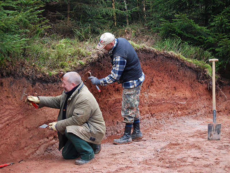
- First photo: R. Smani, LVR-Amt für Bodendenkmalpflege im Rheinland
- Second photo: the Vierherrenstein marks the boundary of the houses of Jünkerath, Kronenburg, Schmidtheim, and Blankenheim – however, the latter is not depicted on the boundary stone. One side of the stone is blank. Photo: A. Wisniewski, Tourist Information Oberes Kylltal