Intersection of Agrippastraße / Aachen-Frankfurter Heerstraße in Zülpich
Intersection of Agrippastraße / Aachen-Frankfurter Heerstraße
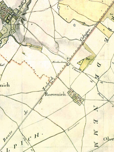
It was established at this busy crossroads in the High Middle Ages as a station for plague and leprosy patients, because the afflicted could so easily beg alms from travelers. The inn that later stood there also suggests that travelers from near and far met here.
This spot was once the intersection of two of the region’s most important long-distance roads: the Roman Agrippa Road, leading from Cologne to Trier and still in use during the Middle Ages, and the Aachen-Frankfurt military road. The fact that these roads were heavily frequented well into modern times is evidenced by the leper house near a Roman road watchtower (burgus) at Rövenich.
The farm track that now leads from Sievernich past the leper house gives no indication that the Aachen-Frankfurt military road once ran here. Its origins can be traced back to the Carolingian era. Archaeologists, however, assume that it had a Roman predecessor. In the Middle Ages, it served not only as a military road but also as a trade route, pilgrimage route, and postal route.
In the 19th century, the east-west route gradually lost its importance or was replaced by new roads from Düren via Zülpich to Euskirchen. The Roman road from Cologne to Trier was also only renovated and rerouted in the second half of the 19th century. By this time, both roads had lost considerable significance compared to the new routes from Cologne and Düren via Euskirchen to Trier and the Rhine, and especially due to the new railway lines in both directions.
Fun to know
- Photo: course of the Via Agrippa on the Tranchot map. Geobasic data from the municipalities and the state of NRW: © Geobasis NRW