Rur Crossing Bridgehead in Jülich
Rur Crossing Bridgehead
Near this location, the Via Belgica crossed the River Rur. The river, named after the Roman goddess Rura, was a serious obstacle to traffic in antiquity due to its irregular water levels. In addition, the Rur did not flow in a fixed riverbed but repeatedly changed its course. As a result, it formed a wide, marshy barrier that was difficult to cross. Today, the Rur is regulated by dams.
A favorable place to cross the river was the narrowing of the Rur valley in the area of present-day Jülich. For this reason, the settlement of Iuliacum was founded on the Rur around the time of Christ’s birth.
The exact location of the Roman bridge is not known. It is believed to have been situated between today’s road bridge and the pedestrian bridge on Kirchberger Straße. On the opposite side of the Rur, a small vicus was established near Neubourheim/Wackersmühle as a counterpart to the settlement of Jülich.
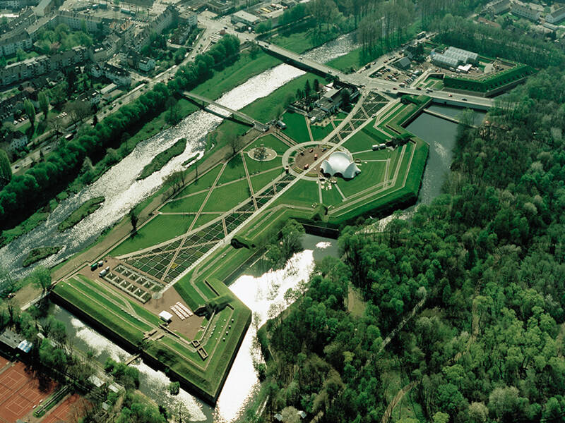
The bridge was a critical point along the Via Belgica. Since late antiquity, it has therefore been particularly well protected: even at the beginning of the 19th century, under Napoleon, the “bridgehead” was constructed opposite the town—an imposing fortification designed to secure the river crossing. This location was also fiercely contested during the Second World War.
Fun to know
- First photo: Brückenkopf. Photo: S. Peters
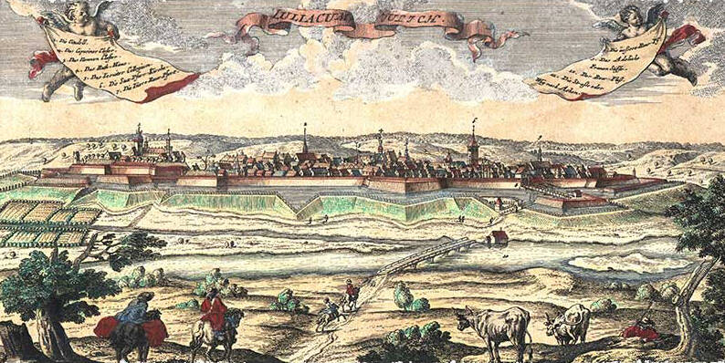
- Second photo: Jülich, depicted by Johann Christian Leopold in a copper engraving after a drawing by Friedrich Bernhard Werner, 1736. Image source: Jülich City Archives
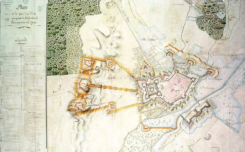
- Third photo: plan of the intended maximum expansion of the Jülich fortress under French rule in 1804. Image: Berlin State Library