Via Belgica in Baesweiler
Via Belgica
As if drawn with a ruler—perfectly straight—the Via Belgica, the long-distance road from Cologne to the Atlantic coast, ran westward from the Colonia Claudia Ara Agrippinensium, the capital of the province of Lower Germania. Even today, over long stretches between Cologne and Jülich, modern roads and paths follow exactly the route of this ancient state road. West of Jülich, however, it lost its importance in the post-Roman period, as connections to Aachen became more significant. The Via Belgica was abandoned, and the land was subsequently used for agriculture.
Through targeted archaeological investigations, the sections of the ancient road hidden beneath farmland can still be traced. In addition to the analysis of aerial photographs and laser scans, methods include geophysical surveys, systematic fieldwalking, and the excavation of trial trenches.
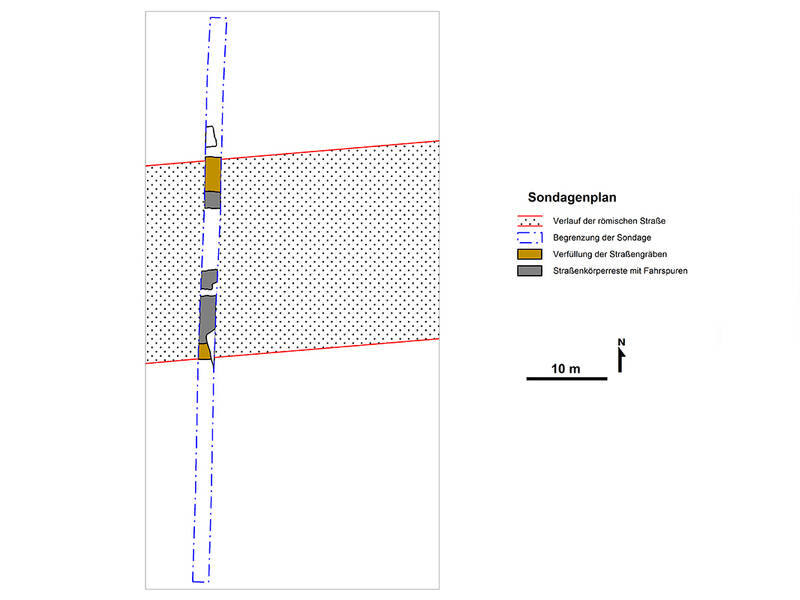
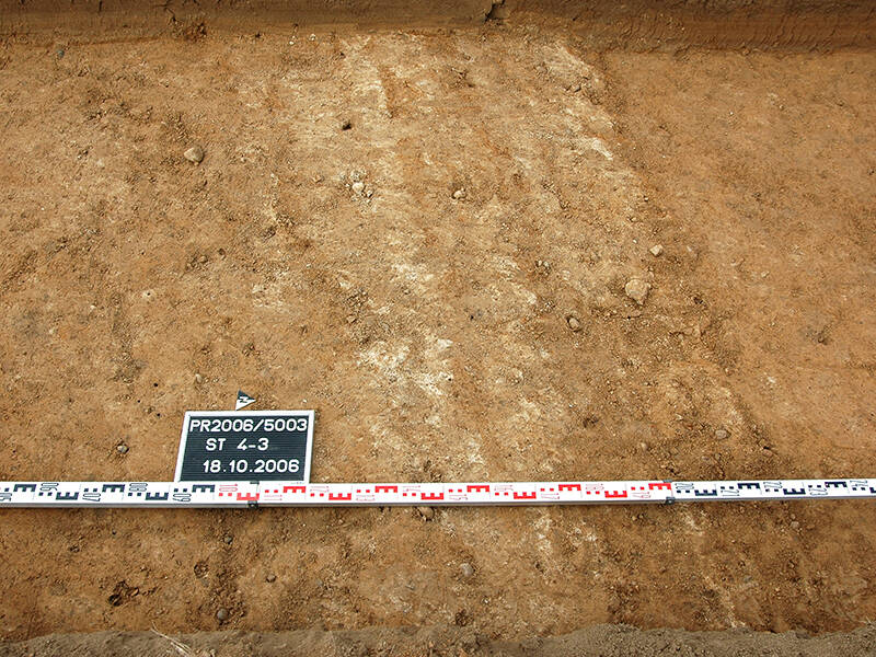
The road, flanked on both sides by ditches, had a width of almost 25 meters from the center of one ditch to the center of the other. The actual surface, covered with gravel, varied in width—from just under five meters when the road was first constructed in the early 1st century AD to about seven meters in its final phase of development. The ditches served for drainage but also marked the boundary of the road area, which was state property. Between the raised roadway and the ditches lay unpaved, sand-covered lanes, known as “summer roads.” Archaeological excavations carried out on site clearly revealed the road ditches and the wheel ruts carved into the ground by Roman carts.
The course of the ancient route is marked in the asphalt of today’s street “Zum Carl-Alexander-Park.”
Fun to know
- First photo: the Via Belgica as seen during an archaeological excavation. Image: R. Dortangs, LVR Bureau for Archaeological Heritage Management in the Rhineland.
- Second photo: wheel tracks of Roman chariots in the Via Belgica. Photo: R. Dortangs, LVR Bureau for Archaeological Heritage Management in the Rhineland